
Sofia Santos: OSINT Exercise #002
This Contains Spoilers!

This is my detailed walkthrough for OSINT Exercise #002, originally posted by Sofia Santos (Gralhix). You can find it here: https://gralhix.com/list-of-osint-exercises/osint-exercise-002/. I set a rule that I could not reverse image search the entire image.
Original Task Briefing (from Sofia Santos):

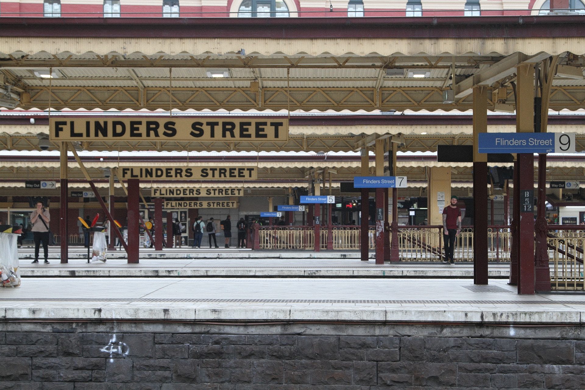
The photo below was shared on social media. It clearly depicts a train station. Please answer the following questions:
a) What is the name of the train station seen in the photo?
b) What is the name and height of the tallest structure seen in the photo?
1. Initial Observations from the Provided Image
My first step was a careful visual inspection of the exercise photograph. I looked at the details and parts of the image taking notes on things that were important.
a) Signs within the station clearly displaying the name "flinders street". This was a strong initial lead for the station's name.
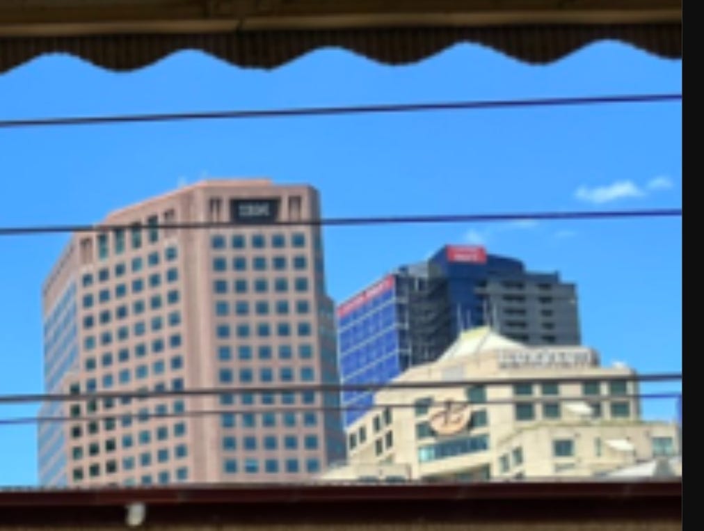
b) A building in the background with the prominent lettering "HWI".
c) Another building in the background marked with "IBM".
d) The red signage on a building in the background.
e) The logo of a building in the Background.

2. Leveraging Reverse Image Search
To identify key landmarks, I performed a Google Reverse Image Search focusing on the distinctive beige building located on the right side of the original image (Marked as E above). I did this trying to find the logo but found more than I was looking for. This search returned several results linking to stock images identifying the building as the "Langham Hotel Southbank Melbourne Australia".
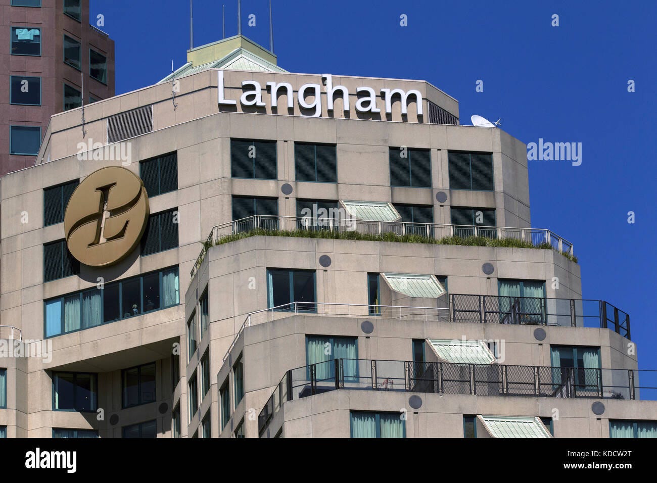
Source: https://www.alamy.com/stock-image-langham-hotel-southbank-melbourne-australia-163166944.html
3. Map-Based Geolocation and Confirmation
With a potential area identified, I turned to mapping tools:
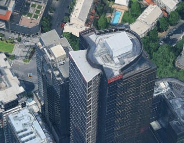
Using Google Earth Pro's 3D view centered on the Langham Hotel, I was able to confirm the presence of the "IBM" and "HWI" towers nearby, which matched my initial observations.
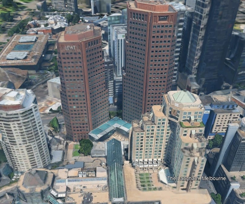
The 3D map view clearly showed that the train station (matching the one in the photo) was located across a river from these identified buildings. Google Earth labeled this station as "Flinders Street railway station", confirming my initial lead.
Wikipedia: https://en.wikipedia.org/wiki/Flinders_Street_railway_station
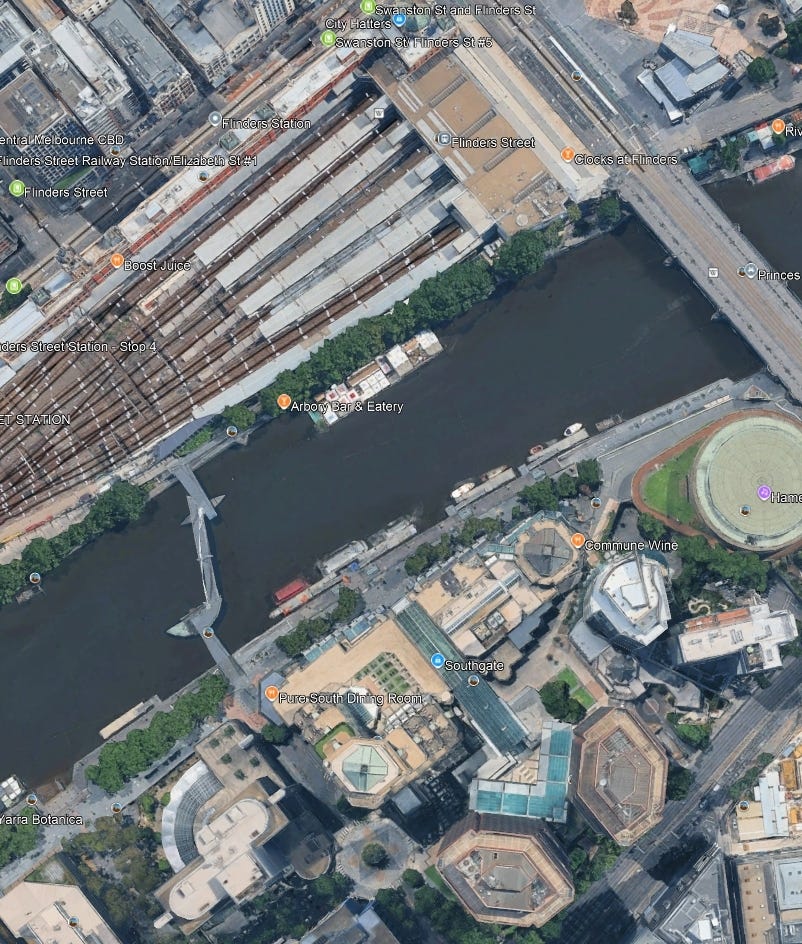
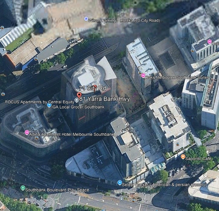
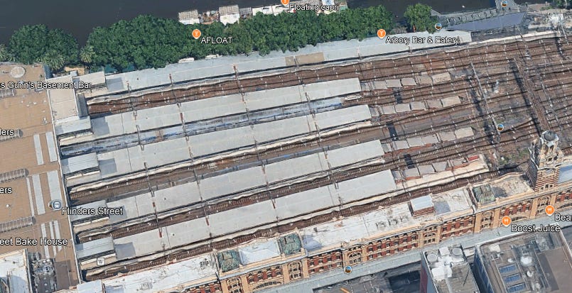
I then used Google Maps to identify other prominent structures visible in the original exercise photograph. Using Google Maps, the highlighted buildings which are in the image can be found. The tallest of these (which I highlighted as a "green building") became my focus for answering part (b).
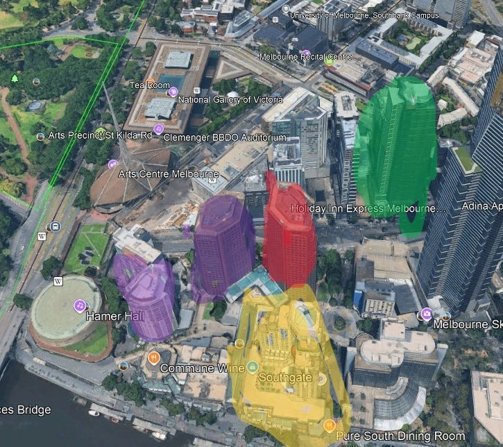
Note that the "green building" is also the same building from part 1 that had the red signage on it.
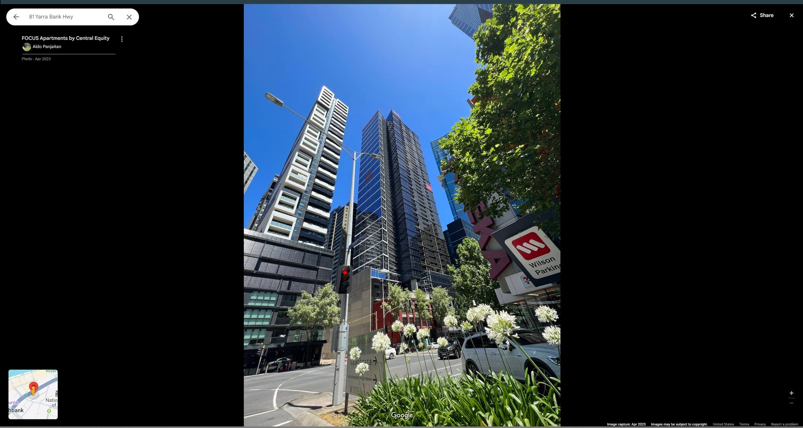
The "green building" (tallest structure) was geolocated using Google Earth and Street View to approximately "81 Yarra Bank Hwy". This way done by simply going to nearest the address on the map and looking at the building. Using image saved at the location from google photos it can be confirmed that this is the correct building.
Source: https://www.google.com/maps/
Note that in the image description the building is denoted as "FOCUS Apartments by Central Equity".
4. Identifying the Height of the Tallest Structure
To find the height of Focus Apartments, I performed a Google search for "focus apartments by central equity building height". This search led me to The Skyscraper Center website, which provided the height as "166m / 545ft".
Source: https://www.skyscrapercenter.com/building/focus-melbourne/38852
5. Verifying My Findings
To ensure accuracy, I performed several verification steps:
Address Consistency: The Skyscraper Center lists the address for Focus Melbourne as “71-87 City Road, Southbank”. I cross-referenced this with "81 Yarra Bank Hwy" on Google Earth, confirming they both point to the same building location.
Visual Cues (Building Signage): I used Google Earth imagery to confirm that the Focus Apartments building features red signage, matching the red signage on the tallest building visible in the original exercise photograph.
Station Appearance Confirmation: I searched Google Images for "Flinders Street railway station platform". The resulting photographs closely matched the architectural style, platform details, and overall look of the station in the original exercise image.
Source: https://www.google.com/search?q=flinders+street+railway+station+platform
Environmental Features (Trees): I was able to match trees visible in the background of the original photograph with trees in the corresponding location on Google Earth, further solidifying the geolocation.
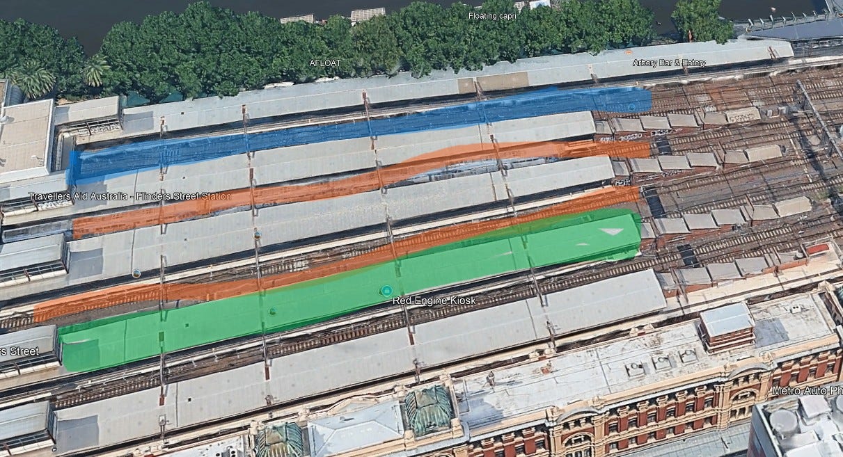
Estimating the Photographer's Likely Position: Based on the orientation in the original image and the layout of Flinders Street Station (platform numbers relative to the Yarra River), I deduced that the photograph was most likely taken from the 4th platform from the water. The map below illustrates my reasoning: Blue highlight = train in original image; Orange highlights = empty track sections; Green highlight = most likely platform.
My Solutions
After conducting the OSINT investigation, I arrived at the following answers:
a) What is the name of the train station seen in the photo?
Flinders Street railway station
b) What is the name and height of the tallest structure seen in the photo?
Focus Apartments by Central Equity, 166m/545ft